Wakefield Local Plan – Hotspots
We have now begun work on responding to the Publication Draft of the Wakefield Local Plan. This is the version that will be subject to Public Examination, by a Government-appointed Inspector, next year. The deadline for comments is 9th December.
The first phase of our work is to look at the proposals alongside CPRE’s campaign priorities for Local Plans, and to identify ‘hotspots’ where the scale or type of proposed development means that impact on countryside is likely to be greatest. We have a list of ten hotspots, and here is a close look at two of them where we have now made site visits.
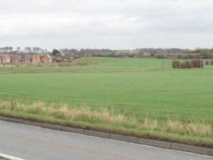
Hotspot 1: South of Knottingley
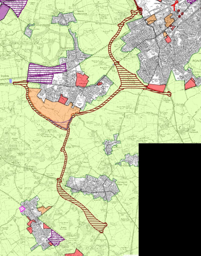
Here is an extract of the Wakefield Local Plan map, showing a large cluster of employment sites around the A1(M)/M62 interchange, and the new road passing through the wildlife network to access the huge urban extension proposal along the southern and eastern edges of Knottingley.
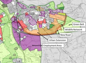
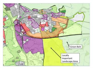
If we add in the detail from the adjacent Selby Local Plan (see next map), we can see that these proposals directly adjoin a Locally Important Landscape Area, which is also within the Green Belt.
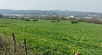
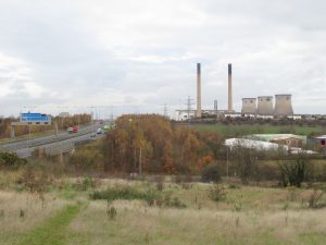
The employment site south-west of the motorway interchange is degraded by unrelenting traffic noise and by fly tipping, yet in the half-hour we visited we saw several dog walkers – evidence that green open space is needed for people living nearby.
The urban extension envisages almost 4,000 new homes in the area, and was recently the subject of consultation on a Knottingley and Ferrybridge Masterplan.
Whilst part of the Masterplan aims to regenerate the centre of Knottingley, it’s entirely unclear from the consultation how well the new development might integrate into the town. How walkable will it be? How much green space will there be, and how will it connect neighbourhoods together with car-free routes? How will the existing wildlife network be protected and enhanced? These are some of the questions that we will be seeking answers to in responding to the proposals.
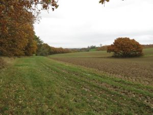
Hotspot 2: Ackworth-Featherstone-Pontefract
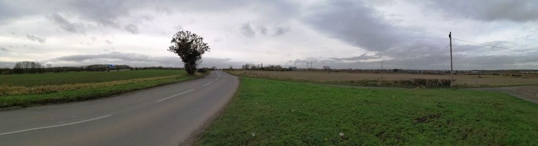
The draft Local Plan proposes a new road which begins between Fitwilliam and Ackworth, through some of the most tranquil countryside in the area. It heads north towards Featherstone where it splits, accessing another urban extension site on the southern edge of Featherstone, and linking eastwards to form an eastern bypass for Pontefract – again through some attractive landscape that currently provides breathing space between towns.
No doubt some people would welcome a road that relieved traffic within the centres of Featherstone, Ackworth and Pontefract, but we know all too well that new roads induce new traffic, and it would only be a matter of time before the new routes were congested. In the longer term there’s also a grave danger that the rural stretch of the route between Ackworth and Featherstone would eventually become a development corridor, and the south-western edge of Pontefract will also be likely to sprawl towards the bypass.
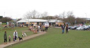
‘Relief Road’ is an oxymoron that should really be consigned to history, and we are very concerned about proposals that will increase overall road capacity in the area. In any case, why take the prettiest parts of your local countryside, where we saw many walkers on our visit, and cut a busy new road through it, damaging wildlife and landscape in the process? Some extension of Featherstone might be feasible without too much damage if carefully designed, but we think the rest of these proposals, particularly the road scheme, are unacceptable.