Stargazers, Royalists and Moravians: from Dewsbury to Pudsey

Join our planning consultant Andrew Wood as he takes a new year walk through West Yorkshire from Dewsbury to New Pudsey.
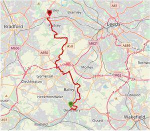
Walk statistics: 23km/14 miles; 6 hours; min altitude 44m; max altitude 192m
View the route on the Viewranger website.
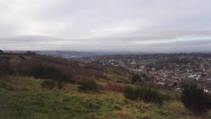
Where better to begin a countryside walk than central Dewsbury? The early morning sun was making a brave effort to illuminate the Town Hall as I set off up Leeds Road, to pick up the Kirklees Way at Crackenedge. I’m soon off the main road but the urban soundtrack of ambulance sirens, train horns and church bells continues unabated. The path rises sharply, and after my first whiff of horses I reach the promontory at Hanging Heaton, with panoramic views to Emley Moor in the south, Hartshead Moor in the west and Morley in the north.
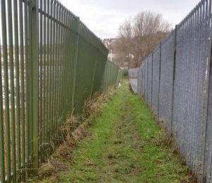
After popping out onto the road at the Fox and Hounds pub, Hanging Heaton, the Kirklees Way drops unceremoniously through the Grange Road Industrial Estate. Here, the footpath traverses a parallel no-man’s land between two fenced-off business premises, and I feel – not for the last time on the route – like a miscreant.
Mercifully, after five minutes I’m over a stile, treading windfall cider under a long-legged apple tree and then bursting out onto the conical hill of Shothill Wood.
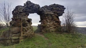
Here I follow a section of dismantled railway at Howley Park Farm and then make a short, sharp ascent to the ruins of Howley Hall for my first coffee break. An Elizabethan hall and now a scheduled ancient monument, the building was mostly demolished in the 18th century, but an old fireplace remains. Ash and blackened twigs show the fire has been used recently. Aside from some electricity pylons, the view here over the moors and the valley is easy to imagine admiring from a well-appointed drawing room.
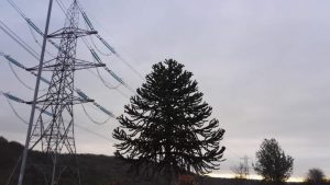
To the east of Howley Hall, almost the whole landscape across a couple of square kilometres is swallowed by the Howley Park quarry and brickworks, but from here there is neither sight nor sound of it. Former workings have been restored to form a golf course. To the west, across a steep-sided valley, is the Wilton Park Observatory at Upper Batley. I also notice some sports pitch floodlights poking above the skyline, and wonder if they thwart the star-gazers.
I skitter and fumble down a muddy field edge to where the Leeds-Huddersfield railway line and the high-voltage transmission lines both cross the Howley Beck, and emerge from a short tunnel under the railway into an altogether gentler landscape. Birkby Brow Wood is easy-going but muddy underfoot. In the solitude, the rumble of the M62 has joined me like a low-pitched tinnitus. A passing couple eye me suspiciously. A smoker’s waft travels at least 50 metres ahead of him despite the still air.
I reach Howden Clough, and figuring out how to get across the M62 has led me to rejoin the Kirklees Way and head west on Leeds Road towards Birstall. Now begins a tedious 3km through two industrial estates. It’s getting close to lunchtime. If the weather had been bad I’d considered diverting into IKEA for weak coffee and cheap meatballs; or a longer route through Birstall to make a stop at Oakwell Hall (famous as Charlotte Bronte’s ‘Fieldhead’ from her novel Shirley). With hindsight I think this latter option would have made a better route than the Kirklees Way; but I’m keen to press on, so I cross the manic motorway at Fieldhead Farm to reach my preferred lunch stop. It’s a murky, moorland high noon as I arrive at Adwalton Moor.
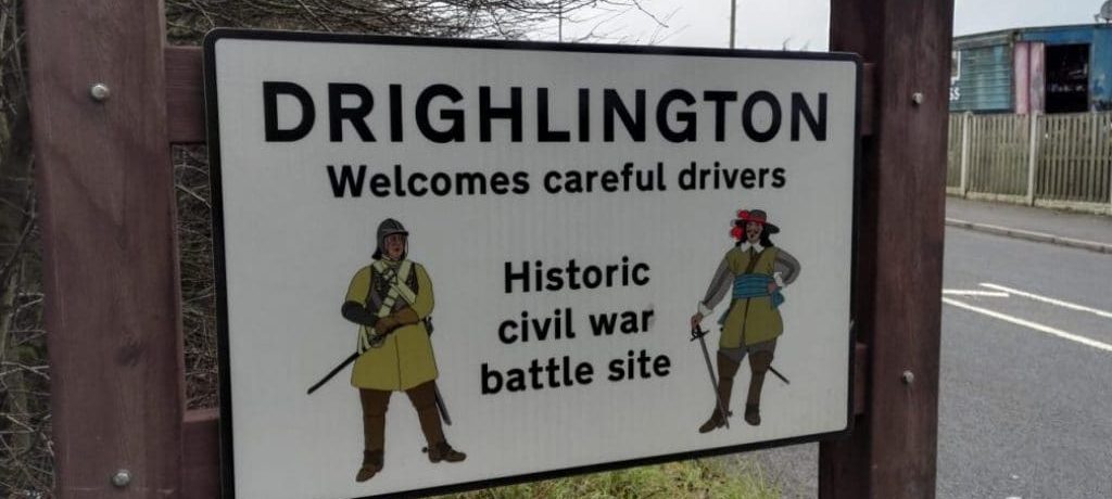
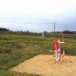
On 20th June 1643, 10,000 Royalists commanded by the Earl of Newcastle set off from Howley Hall, on what must have been a fairly similar route to my own, but without the M62 or the prospect of meatballs to distract them. At Adwalton Moor they met and defeated 3,500 Parliamentarians, of whom 500 were killed. Today, by comparison, is quiet enough for me to enjoy my sandwich, finish my coffee and try the outdoor gym.
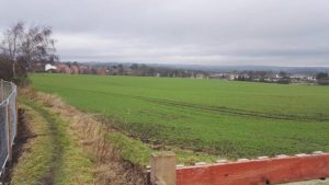
Crossing to the other side of Drighlington I come to Pitty Close Farm, a site recently given planning permission by Leeds City Council for 200 houses. It was one of many ‘Protected Area of Search’ sites around Leeds where land agents have exploited the lack of an adopted Local Plan to gain speculative permissions. It’s a prominent site, and its development will permanently change the character of the landscape. It will roughly halve the open gap of countryside between Drighlington and Gildersome. But the planning system has been so weakened in recent years that it was unable to protect this land from inappropriate development.
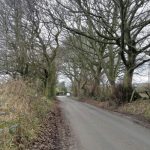
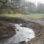
Lumb Hall, just off my route, is a Grade 1 listed building dating from around 1640, with a striking architectural palette including a huge wheel window. Crossing the A58 at Nethertown I rejoin the Leeds Country Way, which drops scruffily down into the delightful, meandering Cockersdale, leading me along the Tong Beck into a lovely remnant of ancient woodland at Nans Whin Wood. A man greets me with a very precise, “Arrfternoon!” to which I respond with an ill-defined grunt: “Ayght.”
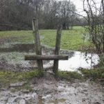
Crossing Tong Lane, and heading west along the Pudsey Beck, I’m on the home straight. It’s the quietest and squelchiest section of the day. Aside from a couple of horses, I have only the sound of my boots squeezing purplish-grey ooze out of the mossy sponge for a good half-hour, eventually passing some disused mills where two young men sit, motionless. Their minds have wandered off on a little narcotic jaunt, their bodies parked awaiting their return.

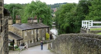
Suddenly, I’m on a golf course, and I can hear quad bikes, and I know that I’m approaching population once again. But there’s one final surprise before I reach Pudsey itself. I drag myself up a stone path to the Fulneck Moravian Settlement. This extraordinary outpost of 18th century Czech life sits calmly along one, straight street, and immediately evokes the joy and relief of the original, exiled community to have found this quiet, fertile, Arcadian spot to make their new home. I also notice that the Moravian Church boasts ‘Organ Concerts on the Famous Snetzler/Binns Fulneck Organ’. The organ was originally the work of Swiss organ builder John Schnetzler in 1748, and Leeds-based James Jepson Binns rebuilt it in the 1930s. The concerts are held on the first Thursday of each month. I resolve to come back to hear the organ’s tones echoing out across the peaceful valley.