From the Dearne to the Calder: Wakefield’s Countryside on Foot

Part One: West Bretton to Nostell, 6th July 2020 (24km)
The Wakefield countryside has been mainly shaped by water, open-cast coal mining and the owners of country estates. But what is it really like? I decided that the only way to find out was on foot. What if the highlights of Wakefield’s countryside were not islands approached only by car, but could actually be connected together using just two feet, a flask of coffee and a sandwich?
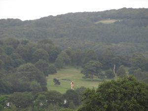
The first leg of my journey (but both of my own legs) joins together four Country Parks – Bretton, Newmillerdam, Anglers and Nostell. I start out on the Barnsley Boundary Walk at Litherop Road, heading north-east towards Bretton Hall. This feels like the kind of descent that you’d expect at the end of a walk, coming down off the moors after a day in the wilderness, so I have this odd feeling of beginning at the end. I’m in South Yorkshire here, and my first glimpse of West Yorkshire comes courtesy of Damian Hirst, whose gigantic ‘Her’ sculpture stands with her back to me, about a mile away between the trees, scratching her bottom. As the path curves, Bretton Hall appears. A heron, taking off heavily, tells me I am nearing water: the River Dearne.
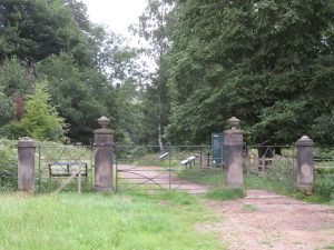
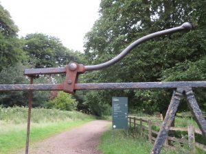
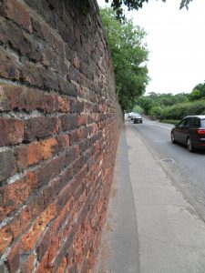
I’m on the three-way boundary between Barnsley, Kirklees and Wakefield, so this is the south-western most toe of Wakefield district. Arriving in Wakefield by the gate into the Bretton parkland, with its beautiful iron linkage, heightens the sense of occasion. The landscape change is sudden, and I’m greeted by a large young man in a padded jacket, his back to me, checking his phone. He is the first person I’ve seen on my walk, and it takes me a moment to realise he is a sculpture.
Last year I wrote for Ways of Seeing West Yorkshire magazine about how Yorkshire Sculpture Park is a kind of portal into people’s ability to experience landscape, with the sculptures acting as tour guides. This is such a calm, well-mannered landscape, yet the sculptures always create surprises and powerful uncertainties. YSP remains closed at present due to COVID-19, and I get a post-apocalyptic twinge as I cut between spaces that are normally open and curated for our enjoyment, but now shut off, allowing just snatched glimpses of sculptures through the hedge. My first fellow pedestrian of the day greets me, jauntily swaying the small bag of poo that he has harvested from his dog.
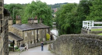
Park Lane in West Bretton is hushed, and has the detailed good manners of a film location for a Miss Marple mystery, with compact, heavy-set houses and beautifully-tended front gardens. Bursting out onto the main road at the War Memorial is a shocking leap forward to the latter years of the Automobile Age, a time when a vehicular assault on the senses is assumed to be normal and immune to challenge.
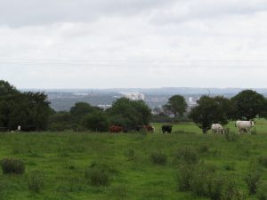
Sadly, I am condemned to an hour of this, as there are no off-road footpaths on my chosen route. I head out along Bretton Lane towards Woolley Edge, there is a moment when I can see both Wakefield and Barnsley town centres, and then I’m approaching the M1. With the wind behind me, I can’t hear the traffic until I reach it, and the service station is well-hidden in the cutting, but once I am over the bridge the motorway won’t leave me alone. Its cacophony follows me all the way as I grind up the road to Woolley Edge itself.
The viewpoint at the Edge is the highest point of my journey, and the westward panorama is uplifting. It’s a clear day, and beyond Emley Moor Mast and the Crow Edge wind turbines I fancy I can see right up to the Pennine Way around Black Hill and Marsden. But there is a lay-by here, and wherever someone can stop their vehicle, you will find fly-tipping. At least, having arrived on foot, I didn’t have chance to bring that broken hi-fi and the bag of empty wine bottles that have been hanging around in my cellar. Maybe another time.
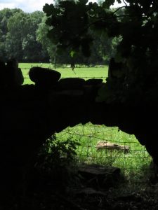
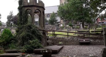
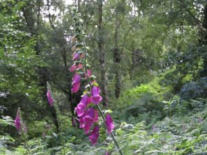
Continuing east along the top of Woolley Edge is a drag, because there is no view and no footpath, and I’m constantly ducking onto the verge to dodge the oncoming traffic. The topography of the road would make for glorious cycling, but I wouldn’t contemplate doing battle with the cars and lorries. After pausing to try to photograph a robin, I arrive alongside a string of parked cars at the junction of Gallows Lane, which tells me there is something here to see. Given the road name, I’m hoping it’s not a public hanging. In fact, it’s Seckar Woods. Dropping down into the ancient woodland, I’m instantly transported. The tranquillity is something to behold, meditative. The burr of traffic remains in the background, but the prevailing sound is birdsong, and the light is beautifully dappled. The floor is a seabed of ferns and foxgloves.

The dark, spring-fed pond in the centre of Seckar Woods was used as a swimming pool in the 1930s, and the woods were once owned by the Barnsley photographer Warner Gothard. One of Gothard’s specialities was postcards depicting events and disasters, usually an image of the incident overlaid with a montage of pictures of the victims. Enthusiast Mark Flynn notes that “being based in Yorkshire caused a problem of how to get to a new disaster or accident to record and photograph the scene in another part of the country”. I’m unsure whether to be relieved by the relative lack of disasters in Yorkshire, or startled that the early 20th century was so hazardous as to keep Gothard busy.
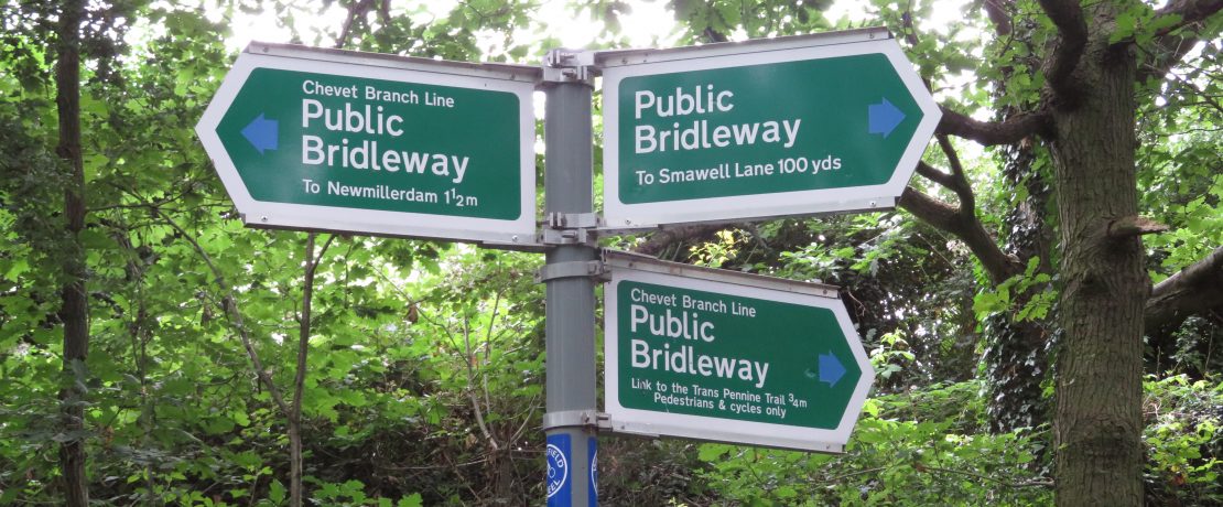
Either way, Seckar Woods is a wonderful place. I’d hoped it would segue seamlessly into Newmillerdam Country Park, but in fact there are a few hundred metres to squeeze along the fenced-off side of an industrial estate. Then I cross over the disused Chevet Branch railway line into the Country Park, and suddenly there are dozens of people strolling. Newmillerdam is really the scenic epicentre of Wakefield’s countryside, and it seems to take you by surprise whichever way you arrive. Yet this place has a complex industrial history of coal mining, corn milling and railways. The beauty and joy has been borne out of a grimy past. Could we aspire to create beauty and joy for the future where there is grime today?
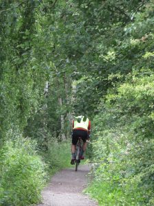
The Chevet Branch line is now a staple of the local cycle network, as well as being home to a nature reserve, and I join it for the next part of my journey. I stay on the line as far as Notton Bridge, and then cross the Barnsley-Wakefield railway line to pick up another cycle path along the disused Barnsley Canal. It’s worth noting that Notton Bridge has the last main road and the last houses I will encounter until I reach Nostell, almost 10km away, yet I’m never more than about 1.5 to 2km away from settlement. This is the Green Belt doing its work: keeping a powerful stretch of countryside open for everyone.
There’s no doubt that these cycle routes are popular for recreational cycling, though I do notice that the cyclists I see today are overwhelmingly MAMILs – middle-aged men in lycra. Also, there are very few places to stop and rest, and at walking pace the routes can become monotonous. I even find myself wondering if swerving off to avoid cyclists is much better than doing so for drivers: if the cycling traffic on this route doubled I’d be spending more time in the hedge than walking. My thoughts drift back to the sweeping, undulating road along Woolley Edge, and I have a growing conviction that we should be reclaiming space for cyclists from car drivers, not from walkers.
Eventually the canal towpath releases its grip, and I’m in the expansive landscape of Cold Hiendley Reservoir, where today the water is as serene as a glacial tarn. I have a couple of fishermen and one young family for company as I sit and break for lunch. The original HS2 route would have me sitting under a viaduct here, but the route moved eastwards, leaving this place to its peace and quiet.
Recharged, I head through Haw Park Wood. This is an ancient woodland that was converted for commercial forestry in the 20th century, but Wakefield Council is working to restore it to a more natural woodland by removing the pines and returning native species. The wood was part of the Walton Hall Estate, once home to Charles Waterton. Waterton was a 19th century pioneering naturalist who, in the manner of 19th century pioneering naturalists, travelled the world collecting specimens for his museum. At Walton Hall he progressed from dead creatures to living ones, building a huge wall around the estate to keep the wildlife in and the poachers out, and doing so created what may have been the world’s first nature reserve.
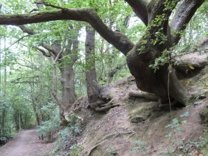

Emerging from Haw Park Wood and into the Anglers Country Park, I notice that I have become a little obsessed with tree monsters. Whenever I see a tree, alive or dead, that has an unusual, gnarly form, I anthropomorphise it into a wizened old character, some of them friendly, some sad, some like the grumpy trolls of fairy tales. I toy with the idea of making a map or guidebook of the Grumpy Tree Monsters of West Yorkshire.
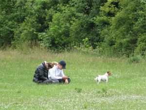
It’s a weekday and the weather is unreliable, but Anglers Country Park is very busy. 40 years ago this was a very deep hole, one of the deepest open-cast coal mines in Europe. The last time I was here was a very cold night in February, for the CPRE Star Count, as the site has the darkest night sky for miles around. Today, the people pursuing their daily lockdown constitutionals are easy to spot, mainly consisting of couples walking quite briskly without much conversation. They’ve said all there is to say today, but they must stretch their legs. A haggle of teenage boys seem to be chatting about their GCSE English syllabus. A few families are picnicking and playing Frisbee, and as a blustery shower comes upon us, a man jumps athletically from his mobility scooter to grab a small umbrella, and proceeds to share its feeble protection with his bored greyhound. All of life is here, and its joyous.
I am briefly dive-bombed by a squadron of swifts, and then leave the Anglers Country Park at its north-east corner, and after about 200m I find a track that joins another disused railway line, signposted as part of the Wakefield Wheel cycle network. This draws parallel with the London-Leeds main railway line, and the path passes between some tall, green steel fencing. I’m now inside a compound that is ungated and unlabelled, and it dawns on me: HS2. If I stand still for a few years, I will be buried under a 20m-tall, 60m-wide embankment. Of course I plan to jump out of the way in time, but I wonder what will become of the walking and cycling route. Dipping through an underpass below the existing railway, I find a surprisingly lovely little woodland whose days, it seems, are numbered.
I’m now ascending into the backwoods of the Nostell Estate. I’m hoping for an unusual perspective on the Upper Lake, which lies to the west of the Doncaster Road. About 35 years ago my mother witnessed a van lose control on the Nostell Bridge and career off into this lake. Although the lake is shallow at that point I’ve always imagined it as a graveyard of vehicles from long-forgotten accidents, where kids go mudlarking for loot from wrecked vans. But the lake view evades me, and I emerge from a tangle of weeds onto the head-spinning hostility of the main road. And my walk ends as it began, with a heron. I stand on the unnervingly narrow pavement of the bridge, one hand on the railings for good measure, hounded by the traffic as I try and fail to photograph the uncooperative bird, as it divides its time between the treetops and the water.