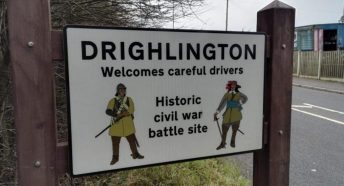
Bronte Country: the Bronte Way from Thornton Bell Chapel to Haworth Church

The Bronte Country in West Yorkshire combines fascinating aspects of our cultural heritage with some impressive countryside to offer an excellent example of the countryside outside the well known Yorkshire Dales National Park that our CPRE Branch works to protect for us all to enjoy.
This walking route follows a section of the Bronte Way from the birthplace of the Bronte children at Thornton to the burial place of most of them in the graveyard of Haworth Church.
Distance: The full distance from Thornton Bell Chapel to Haworth Church is more than 9 miles.
However there are plenty of shorter options including:
- Thornton Cemetery to Haworth Church (around 8 miles);
- Thornton Bell Chapel to Oxenhope (around 6 miles);
- Thornton Cemetery to Oxenhope (around 5 miles);
- Oxenhope to Haworth (around 3 miles).
Maps: To follow this walk route with paper Ordnance Survey maps, you’ll need both OS288 and OL21 – digital mapping is more flexible.
Access: Thornton is easily accessible by bus from Bradford. Haworth and Oxenhope are on the Keighley and Worth Valley Railway↗, a heritage railway line from Keighley, in addition to being on bus routes.
Our journey:
Our starting point is the Bronte Bell Chapel on Thornton Road (the B6145) towards the east end of Thornton village.
The Bell Tower from the chapel is all that remains of the church where Patrick Bronte was appointed in 1815 and was vicar when his four children were born in Thornton↗. The “new” St James church was constructed in 1872.
Walk east along Thornton Road past St James Church, then turn right up Bronte Place to Bronte Old Road. Turn left along Bronte Old Road, which becomes Market Street, to reach the Bronte Birthplace.
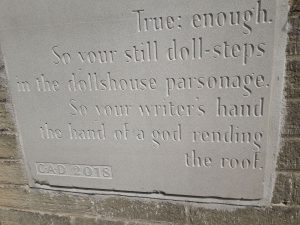
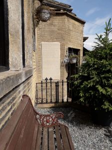
The Bronte birthplace is marked by a black plaque detailing the years in which the four surviving children were born between 1816 and 1820. The birthplace is now also home to the more recent Charlotte Bronte Stone, one of the Bronte Stones↗, carved in 2018 with a poem by Carol Ann Duffy.
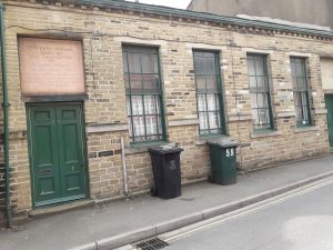
As you walk along Market Street, you pass Kippin Chapel School, built in 1819: a reminder that the non-Conformists were active in these expanding industrial communities at the same time as Patrick Bronte was championing the cause of the poor on behalf of the established Church of England.
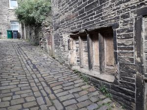
There are some fascinating nooks and crannies in Thornton including this cobbled street. This street has been literally made up over the centuries so that the nineteenth-century cobbles have begun to obscure the corner of the seventeenth-century window on the ground floor of the old house.
At the east end of Market Street, bear right up West Lane and continue to the junction where James Street joins it from the left. Continue walking to the right up West Lane for a short distance then turn left along Reservoir View. At the end of the houses on Reservoir View take the walled track going east which opens out into a path through the fields. The path becomes another walled track to reach the Cemetery at the west end of the village.
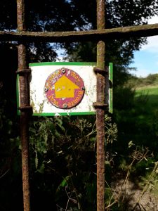
Walk through the Cemetery and at the western end look out for the Bronte Way footpath sign on the iron gate – with both gate and footpath sign showing signs of their age.
Follow the path across the edges of the fields to Close Head House then walk up the track to cross the road west of the White Horse.
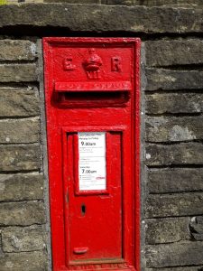
As you cross the road at Well Heads, it’s easy to spot this red postbox in the wall – and it’s unusual because Edward VII only reigned from 1901 to 1910!
Walk west along the road then turn right at the footpath sign and follow the path across the fields towards Morton End, staying to the left of the farm buildings.
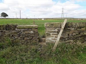
Head west and slightly downhill from Morton End farm to reach this typical squeeze stile through the dry stone wall (apart from the modern cemented repair!) into the next field. The old stones used to step over the stile have been worn down by centuries of people – probably including the Brontes – passing through this way from Thornton to Denholme Gate. Squeeze stiles are common in West Yorkshire’s boundary walls as a practical means of allowing people to squeeze through a gap that’s too narrow for a sheep or cow.
Follow the path through the gate crossing the fields to reach the rougher ground of the clough at Denholme Beck then continue on the path towards the house.
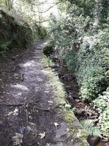
Near the house, your path turns left alongside the beck along an old man-made walkway with an old wall on the left covered by moss and ferns. As you ascend to emerge onto Brighouse Road, the A644, there are signs of old structures below the path now long disused.
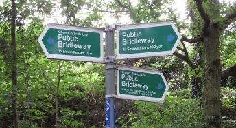
The Bronte Way is well signed, but spotting the signs can be challenging, including one sign high up on the lamppost!
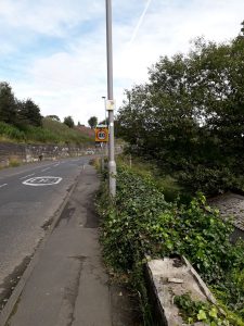
Turn left to follow the A644 for a short distance then turn right up Cragg Lane to take the path on the right behind the houses up to join the A629 road to Halifax.
Turn off the A629 into Black Edge Lane passing between a terrace of cottages on your right and their outbuildings on your left. These will have served different functions across the centuries such as outside toilets and coal stores before their current use for storage – especially of wheelie bins.
This stone is now built into the boundary wall of the terrace. It is a good example of current practice in 1822 showing the initials of the cottage owner and the original building date – around the time when the Bronte family were young children.
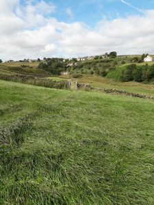
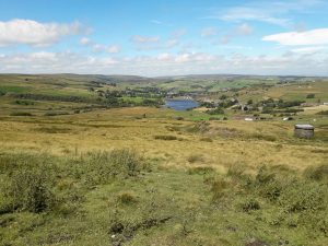
Leaving the cottages and Denholme Gate behind, the walled track, now Thornton Moor Road, leads onto the moor to give extensive views such as this view which shows how much open countryside we have in this part of West Yorkshire.
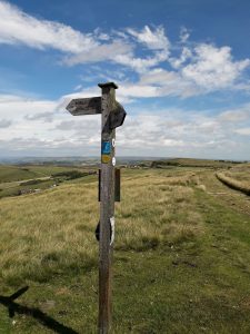
Pass the water works associated with the reservoir on your left, then this signpost reassuringly points the left turn on the Bronte Way towards Oxenhope amid a plethora of routes.
Another fantastic view of the countryside looking north from the Bronte Way, clearly showing the rough pasture of the higher ground contrasted with the cultivated fields below. The Bronte family would not have seen this Reservoir, which was constructed in the 1870s to supply the increasing demand for water from the local mills.
This signpost points to the path down from the high ground of Thornton Moor. The Bronte Way takes you downhill from here, initially across rough ground, towards the left-hand side of Leeming Reservoir. On its descent the path crosses the line of the Stubden Conduit.
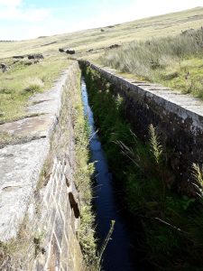
These open conduits are a feature of the Yorkshire moors, an integral component of the substantial Victorian engineering works undertaken to ensure an adequate water supply for the increasing number of mills and the increasing population of the communities in the valleys below.
As you reach the lower ground alongside the left-hand side of Leeming Reservoir, the path reaches a gentler valley landscape with attractive views across the water. Then drop down into Back Leeming along Jew Lane to join the B6141 on the southern fringes of Oxenhope. Turn left along Station Road, the B6141.
At the crossroads turn right to follow the quieter Yate Lane running north along the edge of the village.
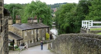
At the T junction, turn left down Dark Lane to reach the A6033 Keighley Road. Cross this road into Harry Lane and go downhill to explore the station, have a rest in the park, or to continue along the Bronte Way towards Haworth.
In Oxenhope, the Bronte Way route takes you past some good examples of the 20 mills that were flourishing in the village by the late 1800s. The arrival of the mills and the railway must have transformed the small hamlet that was here in the 1820s.
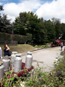
Oxenhope Station↗ is on the Keighley and Worth Valley heritage line with steam engines still working to the delight of passengers and passers-by. This photo also shows a load of milk churns waiting at the station having been brought in from local farms to be transported to Keighley and Bradford before the days of bulk liquid carrying tankers.
Across the road from the station is a small park with useful picnic tables if you’re ready to sit down for a rest before catching the train or continuing your walk to Haworth.
When you’re ready to continue to Haworth, return to Mill Lane in the direction of Harry Lane. At the bend, where Mill Lane becomes Harry Lane, head away from the village on the path past Wilton House alongside Bridgehouse Beck.
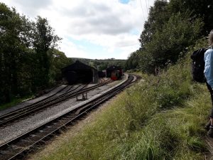
Your route crosses the railway track with a good view back towards the engine sheds behind the station↗. The path across the fields climbs steeply up from the valley bottom at Oxenhope, then the gradient becomes easier as you approach Marsh Top and reach Marsh Lane.
Cross Marsh Lane and walk left along the road for a short distance to the first road on the right. Take this right turn into Old Oxenhope Lane. The lane soon bears sharp left but you continue ahead on a track between a pond and some buildings then across the fields. This section of the Bronte Way leads you back up onto open countryside.
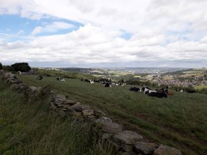
Now you’re rewarded with excellent views like this view looking to the north east along the Aire Valley towards Keighley. Look out for the right turn in the footpath then follow the marked pathways down towards the north end of Haworth village.
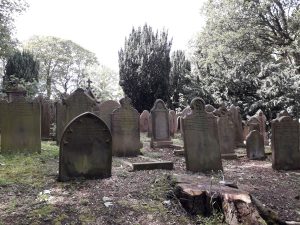
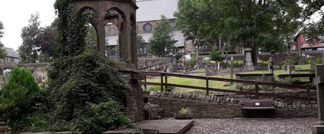
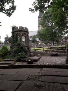
As you leave the fields, an early sight as you enter the village of Haworth is the churchyard, where you can pause to look at the Bronte graves.
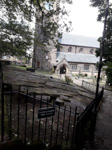
Here our route ends at Haworth Church. Continue from here to explore the village with its cobbled streets or the Bronte Parsonage Museum↗ next door to the church.