Esholt – Site Geography

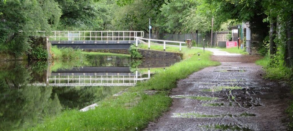
On a visit to the site a couple of weeks ago, our planning consultant Andrew Wood familiarised himself with the geography and corresponding history of the landscape in a Walk around Esholt.
He passes ‘a flat-bottomed basin in the landscape that was once an aerodrome, and subsequently Leeds’ second largest water treatment works. Technological advances have rendered much of the acreage of the works obsolete, and there are now plans to redevelop it. There is already a small business park lurking deep within the site, as is the Grade II listed Esholt Hall, which is currently part of the Yorkshire Water estate.’ This is the proposed site for a larger business area, apparently aimed at biotech companies. It’s a big brownfield site. It is important that the most is made of the site, without causing harm to the surrounding area. Finding the right balance for positive planning is tough.
The contours of a planning application site can often be hard to visualise. Getting out and experiencing the local geography in relation to a planning proposal can be really helpful. The site plan of the planning application gives an overview. Map 26 of the Leeds/Liverpool Canal produced by Bradford City Council provides a starting point. We will be arranging a CPRE Planning Walkabout of the Esholt area and will post details when these are confirmed.
The Yorkshire Film Archive has a fascinating film about Esholt sewage works from 1947. It provides information about the original layout and Esholt’s early recycling credentials. It was a bold move by Bradford Corporation to buy the Esholt Estate in 1908 and relocate their sewage treatment works there via a three mile long tunnel from Frizinghall.
On his walk, Andrew’s route takes him along the former works railway line, past disused settling tanks. This is the area earmarked for 150 homes. The Esholt planning application is a Hybrid application, so although there is not much detail about the business development, the housing site is a ‘Full’ application, where all aspects of planning are addressed and not ‘reserved’ for a later date.
Andrew’s initial thoughts are that ‘such a large site could potentially accommodate more, higher density homes. Why redevelop a large site like this and not make really efficient use of it? It might be that, with so much scope for shared green spaces, there is less purpose to individual gardens.’ We will need to take a closer look at the submitted plans to form a view on this. Over the next few weeks, we will be sharing out thoughts as we unpick and assess the Esholt application and start to understand its implications, and opportunities. Feel free to join us, and join in the conversation.